Hamburger Hill tour Vietnam, Visit Hamburger Hill, Vietnam Hamburger Hill tour, Hamburger Hill tour from Hue
Hamburger Hill tour Vietnam
Climbing Hamburger Hill - 50 years after the Vietnam War’s brutal, haunting battle By Paul Schemm May 10, 2019 at 7:00 a.m. EDT
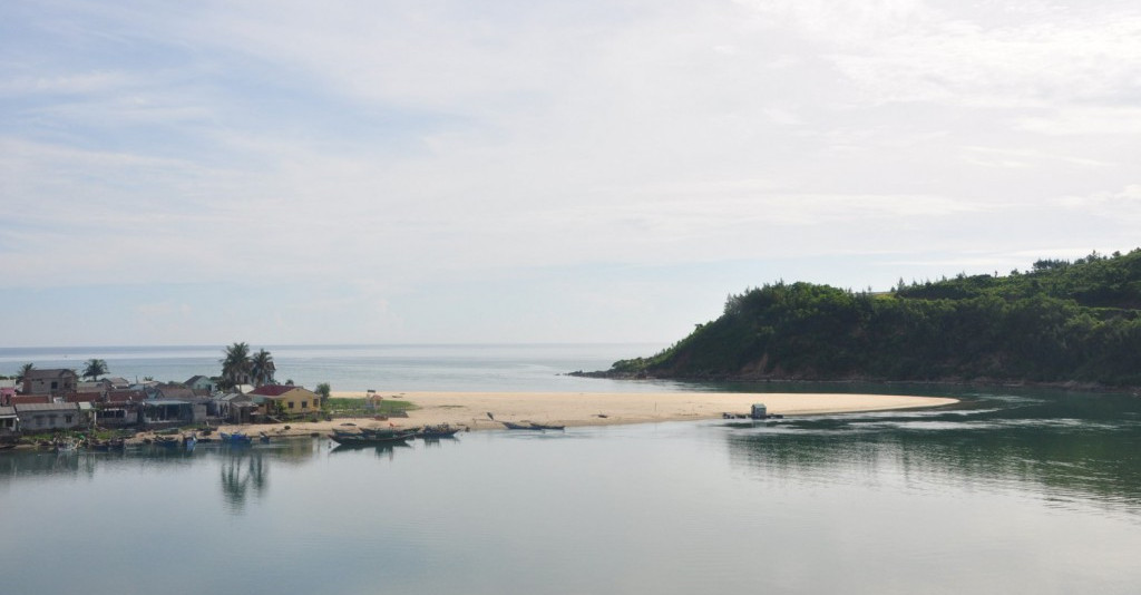
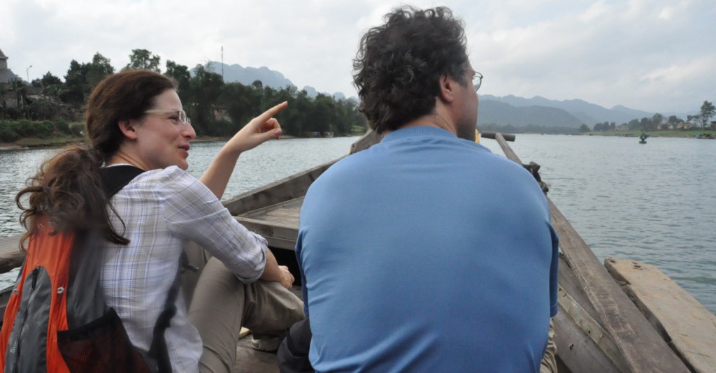
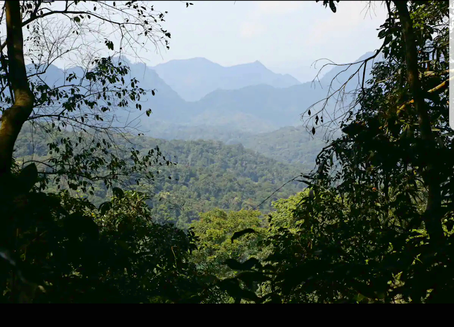
DONG AP BIA, Vietnam — We climbed the worn stairs heading steeply up the mountain into the heavy jungle. They looked like the way to some forgotten temple complex a thousand years old but had actually been built just 10 years ago to ease the ascent to Dong Ap Bia, the Crouching Beast, Hill 937 — Hamburger Hill. It is one of the most famous battles of the long Vietnam War. It inspired a movie and congressional hearings, symbolizing for some the incredible bravery of the American infantry in Vietnam and for others the futility and waste of the war. We weren’t climbing those stairs to settle that question, though we had others. Where exactly on this hill had the battle been fought all those years ago? On May 10, 1969, the U.S. Army’s most decorated unit, the 3rd Battalion of the 187th Regiment of the 101st Airborne Division, known as the Rakkasans, spent 10 days taking this hill against a deeply entrenched enemy. Every year the veterans mark the anniversary of the battle in Fort Campbell, Ky., and this year it’s the 50th. The approach from the east side of the hill was the easy way up. This terrain didn’t play much of a role in the battle; instead, accounts of the war describe most of the 10 days of brutal combat taking place on ridges to the north and west of the hill.A view of the A Shau Valley fromthe Hamburger Hill thí year.The stairs were still pretty arduous, but my companion Jonas Thorsell and I had been living in the high altitudes of Ethiopia for the past few years and powered up the slope, leaving behind our guide, Van Vu, as he stopped to suck down local cigarettes.
Thorsell, a 49-year-old Swedish entrepreneur now in the electric scooter business, used to live in Vietnam and became fascinated by the old bases and battlefields of the war. He began blogging about them on his website, giving tips to those interested in returning to visit. His work has increasingly put him in touch with veterans seeking news of their former haunts, and for the 50th anniversary, he was producing a video for the Rakkasans showing the actual location of their assaults up the hill for the first time. “It is a rediscovery, it is a journey to remember our friends who did not come home,” wrote Mike Smith, 70, who was a private first class with Delta Company’s 2nd Platoon. “No one has been able to provide the time and dedication to understand the scope and conditions of the battle in which it was waged, then find it, without Jonas.” I’d grown up in a military family myself and was raised on such 1980s films as “Platoon,” “Full Metal Jacket” and, embarrassingly, “Rambo,” so I had long wanted to climb the hill myself. For the past 20 years, veterans have been coming back to Vietnam to rediscover the places where they lived and fought so long ago. Our guide Vu has gained an almost encyclopedic knowledge of the many bases in this area between Hue and the Laotian border.
“For most of your vets, they are really emotional when revisiting the sites where they were stationed and operated,” he said, adding that some were still bitter about the war after all these years. He said his country’s veterans are proud of their struggle and suffering, too, but that most young Vietnamese aren’t particularly interested in hearing about their sacrifices. “They are looking forward to the future and making money.” For all his knowledge, though, Vu was also unfamiliar with the actual site of the fighting on the hill and followed our rough maps cobbled together from satellite images, veteran memories and after-action reports.
‘Fear and agony’ The battle for Hill 937 was kind of a high-water mark of U.S. operations in Vietnam. At the time, there were more than 500,000 U.S. troops on the ground, and this was a rare moment when the North Vietnamese forces stood and fought. By the end of the year, President Richard Nixon began his drawdown of troops, and there was a shift in emphasis to getting South Vietnamese troops ready to bear the brunt of the fighting.
In this operation, however, some 2,000 U.S. troops sought to remove the infiltration routes of enemy troops and materiel from Laos into South Vietnam around the key city of Hue and the massive air base of Danang farther south.
The Tet Offensive the year before had been particularly hard-fought around Hue, and the North Vietnamese had moved their forces from Laos into Vietnam through the A Shau Valley. The Hamburger Hill battle, part of Operation Apache Snow, was designed to wrest the valley back from the North Vietnamese, who had held it ever since a Special Forces camp in the valley was overrun in 1966. Most people stop at the memorial, but we kept going up to the summit, where the tall trees were replaced by six-foot-high, razor-sharp elephant grass, and the temperature soared as the sun beat down on us without the protection of the tree canopy.
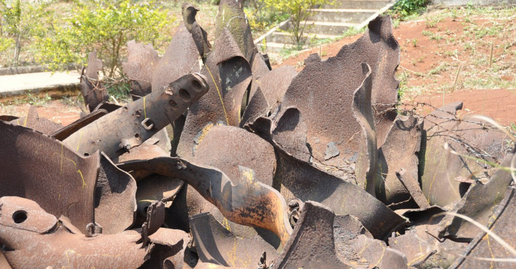
From there, we worked our way back down the mountain, trying to figure the paths of the American assault in reverse. We discovered trails that led off the summit onto ridges that plunged down the hill. This was where it happened 50 years ago. These were the routes the American soldiers charged up into the teeth of an entrenched enemy protected by layers of mines and massive log bunkers that were impervious to airstrikes. There’s little evidence left of that awful violence from half a century ago — a torn bit of fabric from an army poncho liner, holes dug around boulders that could have been fighting positions. Vu noted that in the lean years after the war, many Vietnamese dug through the old battle sites looking for scrap metal to sell. His toys growing up were old bits of war materiel.
In his granular recounting of the battle, a book titled “The Crouching Beast,” Lt. Frank Boccia, who commanded Bravo Company’s 1st Platoon, described how his company was sent up the hill on a routine reconnaissance patrol with a vague mission to look for supply dumps, then ran into an ambush in a clearing. “Hollow booms — claymores: two dull, flat slams — RPG. AK-47, like a stabbing icicle, the sounds registered. And then a vicious, mind-freezing deep thumping, a pounding, crushing sound I’d never heard before but recognized instantly: .51 caliber machine gun. . . . Then the screaming started. Yells for help, or a medic, and inarticulate screams of fear and agony.” The men of 4th Platoon were hit by the massed fire from several bunkers and cut to pieces. Meanwhile the men of Charlie and Delta companies, making their own way up the hill, also were thrown back — a strange moment for the Americans who weren’t used to the enemy standing and fighting. “We began to wonder about what kind of place this was and why they were defending it,” recalled Dennis Helms, now 70, the radio man for Bravo Company’s 1st platoon. “Over the course of the battle, we made a number of assaults up the hill, and we would come back down each time because we had limited space to move in, and it seemed as if all their weapons were trained on the clearing, and we just couldn’t seem to get past that,” he said in an audio recording of his recollections.
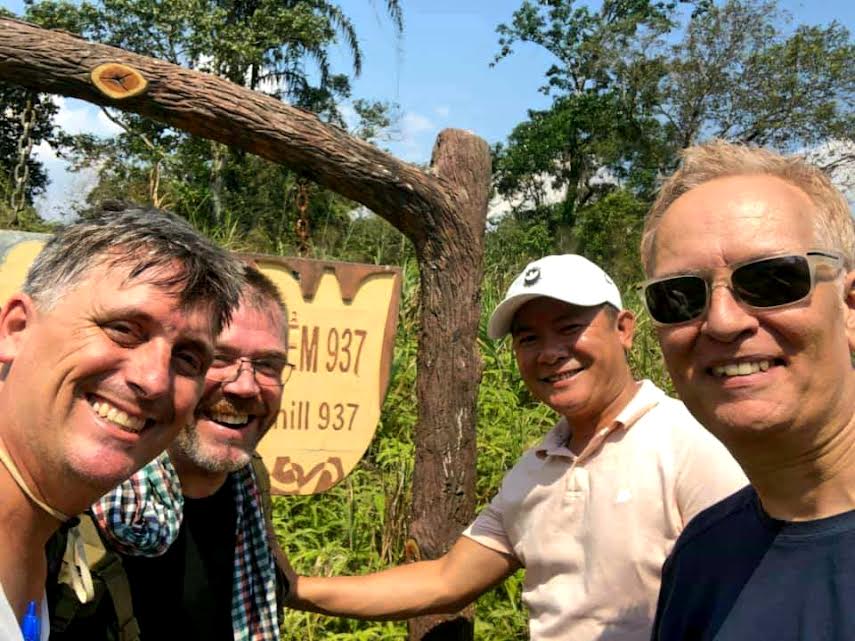
“Every assault was a somewhat different scene but had the same outcome. It just depended on where they wanted to hit us when we first came in the clearing or got past the clearing,” Helms added. “The noise level was also so unbearable.”With Mr. Vu on the summit of the Hamburger HillDocuments found on dead Vietnamese soldiers later revealed that the U.S. troops had stumbled upon North Vietnam’s 1,000-man 29th Regiment, known as the “Pride of Ho Chi Minh.”
For days they were sent back up that hill, each time thrown back — sometimes by the Vietnamese heavy machine guns, sometimes by the mines they sowed into the slopes and twice even by friendly fire, first when a fighter jet dropped a bomb too close and the second time after an attack helicopter accidentally rocketed their company headquarters. “That broke our back that day,” Helms said. “The battle was bad enough, but having our own gunship fire us up was a hard pill to swallow — it was very demoralizing.” Over the course of the fight, the U.S. troops faced counterattacks, called in airstrikes and tried to evacuate their wounded even as several of their helicopters were shot down. Through it all the enemy held their ground, even as nearly every bit of vegetation in the dense jungle on the summit was leveled.
Then on the 18th, yet another assault was defeated, this time by heavy rain.
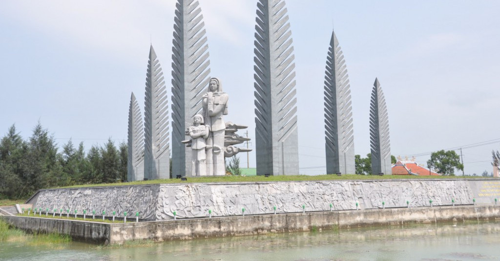
“It rained hard, hard, hard. It was just a big mud bowl. You’d take a step forward and slide down four feet,” recalled Robert Harkins, now 75, then a captain and leader of Alpha Company. “There wasn’t a lot to grab on to. Most of the vegetation was gone by this time. We lost the support of all our helicopters because of the weather.” On May 20, the much-mangled 3/187 Battalion, with help from other units, finally took the hill and mounted the summit, which by this time was a scene of near moon-like devastation. About 70 U.S. soldiers died, and many more were wounded, with the 3/187 experiencing casualty rates of more than 50 percent in three of its four companies. Platoon leaders, the junior officers who charged into the fray with their men, were particularly hard hit. Only four out of a total of 14 made it through the battle relatively unscathed. The U.S. troops didn’t stay long, and the hill was soon abandoned, an outcome that became the focus of congressional hearings featuring Sen. Edward M. Kennedy (D-Mass.), who called the battle “senseless and irresponsible.” The 1987 film “Hamburger Hill,” in particular, struck an antiwar note that has long bothered the veterans, along with its historical inaccuracies. “Had we faced the terrain shown in the movie, we’d have won the first day,” Boccia remarked bitterly once to Thorsell. “You’d think they’d have gotten something right by accident.” “No girls, no hot tubs, no trucks. The movie was crap and did not relate to a real 3/187th soldier in the A Shau Valley that I experienced,” Smith agreed in an email. For those who fought in it, the battle wasn’t about holding ground but about taking back control of a supply route that had been in the hands of the enemy for years.The monument at the top of Dong Ap Bia, the scene of heavy fighting in 1969 “I believe we did what we were sent to do. We were to open up the valley; we opened up the valley. We were to kill the NVA; we killed as many of the NVA as we could. The hill had no tactical or strategic purpose other than the NVA were on the hill,” Harkins recalled. More than 600 North Vietnamese Army (NVA) soldiers are estimated to have died in the fight. ‘Unselfish acts of bravery’ The central valley remained clear of North Vietnamese for several months afterward, until the United States began drawing down its forces. Smith, one of the veterans, said he recalls his time in Vietnam every day. For him, what made the battle such a definitive moment were “the unselfish acts of bravery exhibited by so many soldiers, not to earn any awards but to take care of each other, help each other survive, and still continue the battle. “ Thorsell, Vu and I finally made our way back up the steep trail to the summit that took the Rakkasans 10 days to seize, and then we slowly made our way back down those worn steps off the mountain, our legs rubbery from the long day of climbing. As we stepped back into our car, a small party of Montagnard tribesmen, the indigenous people of Vietnam’s Central Highlands, came down the mountain behind us. They had probably been trapping small animals in the forest, Vu explained. Fifty years after the battle, Hamburger Hill, now at peace, belongs to them.

.jpeg)